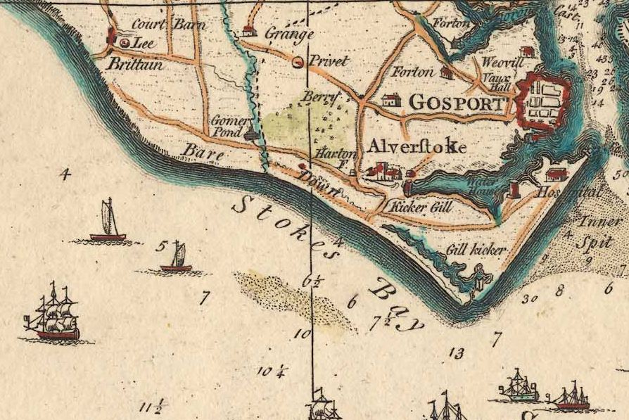
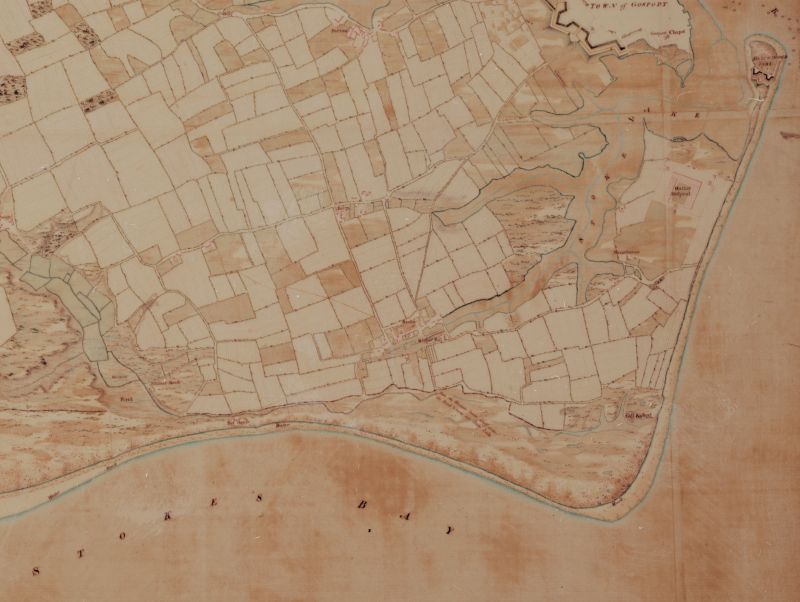
Gilkicker & Kickergill
Gilkicker stood on the site of Hasilworth Castle and was earlier known on maps as the ‘Gill-Kicker’, Kickergill was at the end of Clayhall Road at Alverstoke and was shown on some maps as the ‘Kicker-Gill’. By lining up both sea marks sailors could find the safe water channel into Portsmouth Harbour and avoid the shallow Warner and Norman Sands. The origins of the names have never been successfully explained although there have been some theories but the point at ‘Hasilworth’ seems to have changed to Gilkicker Point after the erection of these marks. Daniel Defoe, writing in 1724 mentions “…the point of land on the side of Gosport which they call Gilkicker and where also they have two batteries“. Did Gilkicker Point gain its name from the sea mark or was it the other way round? Henry Slight refers to ‘Near the point of land called the Kicker..’ Could it have been boot shaped?
Kickergill was constructed at the order of Robert Rich, The Fifth Earl of Warwick, Parliamentary Admiral to Charles the First (1625-1649). Kickergill and its partner Gilkicker were constructed circa 1658. Henry Slight, writing in ‘Chronicle History of Portsmouth’ in 1835, reports that the inscription that was displayed on the Gilkicker sea mark was as follows:
This sea mark was erected by Robert, Earl of Warwick, Admiral of the seas – Captain Richard Blith Sen. his captain in the Prince Royal and W. Cooke, master of attendant his master.
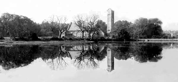
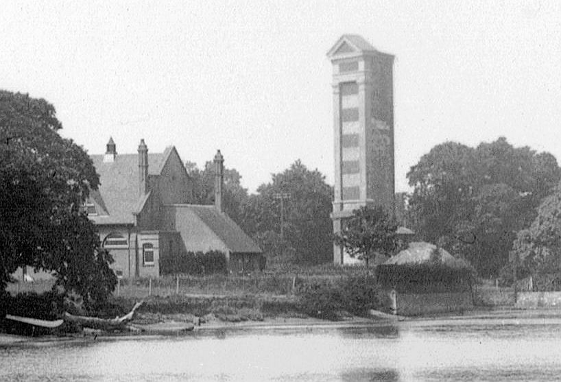
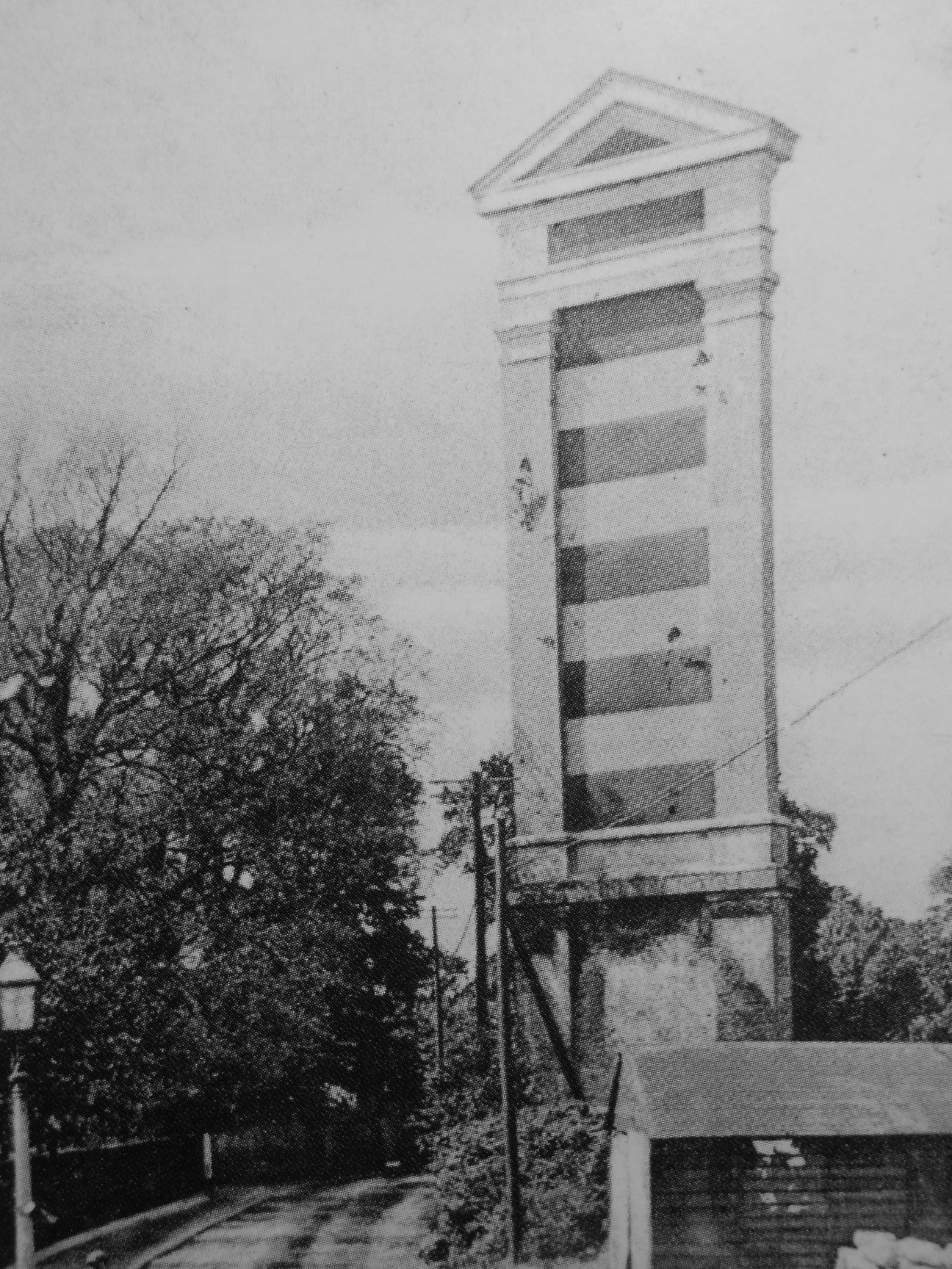
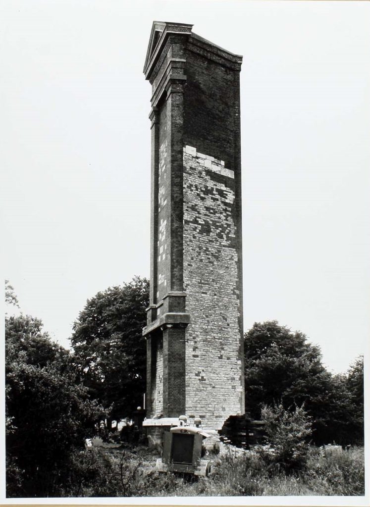
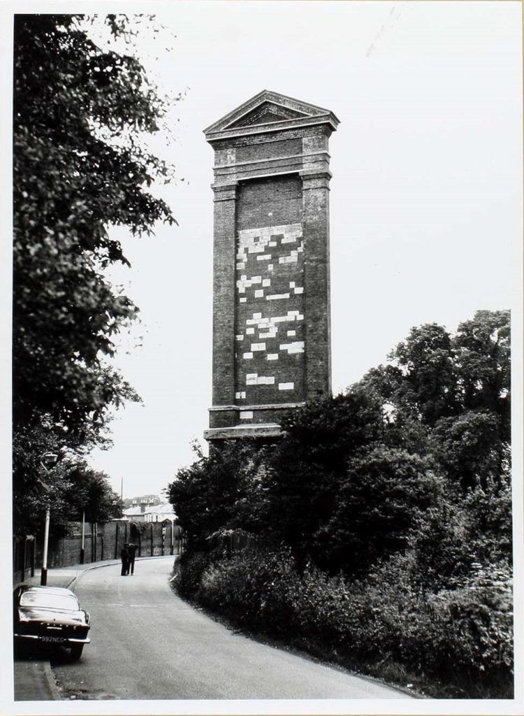
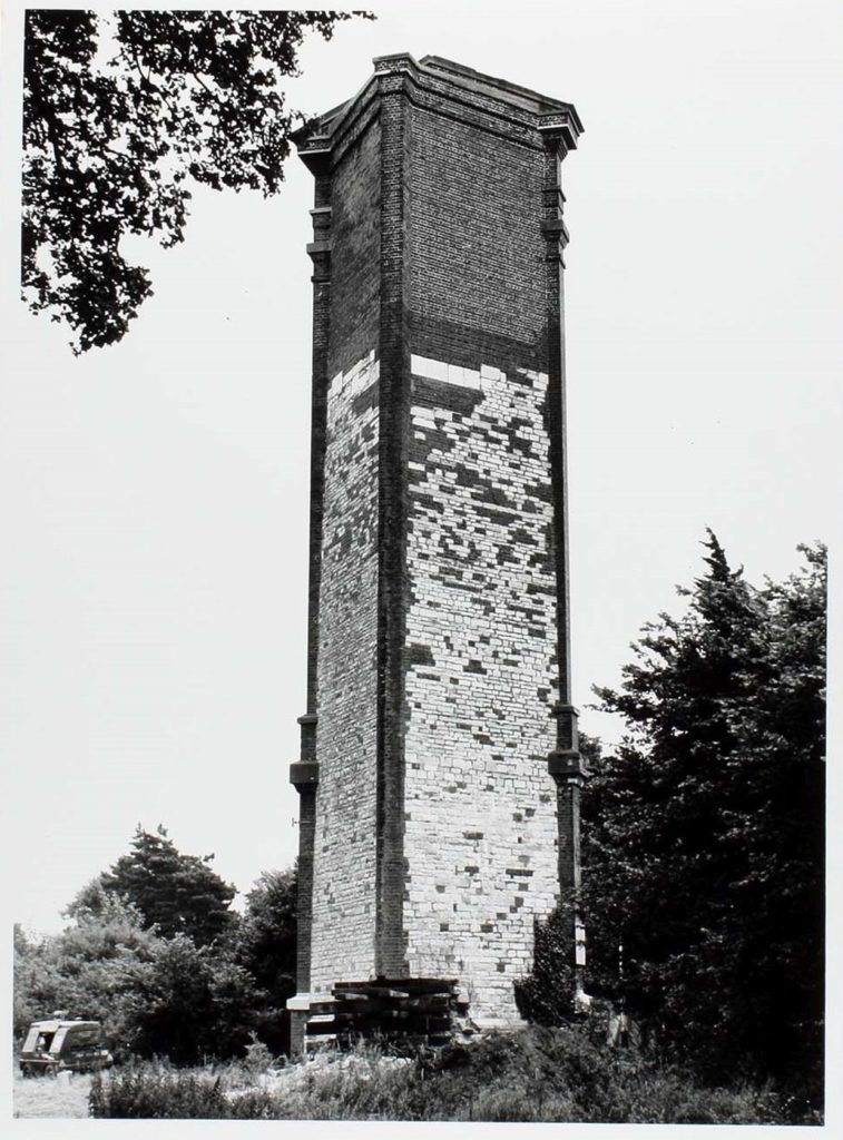
A coat of arms was placed below the inscription. There is no record of an inscription on the Kickergill. No drawings or illustrations of the Gilkicker have so far be found. Grenville Collins described the Gilkicker in ‘Great Britain’s Coasting Pilot’ as ‘a white tower’. This Portsmouth master mason said that it was of plaster and 124 feet long (considerable larger that its back marker, the Kickergill) on its south-eastern side, the side that faced the sea and had become dull. Gill-Kicker presented a rectangular front, with its other two sides sloping downwards so that the rear point of the triangle was lower (Grose & Astle 1784), whereas Kicker-Gill was of even height on all three sides, until a triangular pediment was added on top of the front in later years (Pevsner & Lloyd 1967). When the Kickergill was demolished in 1965 it was revealed that it was constructed almost entirely of brick, with the side columns painted white and stripes of white painted horizontally across the face. This made it more visible from the sea and gave the impression that it was constructed of stone when viewed from a distance. It was reported by old Gosport residents that they referred to it as ‘Bread and Jam’ because of its red and white layers, though it later years the white became very faded.
‘Hampshire and the Isle of Wight’ written by Pevsner and Lloyd in 1967 says …Gilkicker tower built in 1669 (see above for the accepted date) and heightened in the C18, the original part in stone, the later additions in brick ending in an oddly placed pediment brought out in several delicate orders of moulding. The intermediate part was a most attractive medley of dark red brick and silver stone. The tower was wantonly destroyed in 1965.
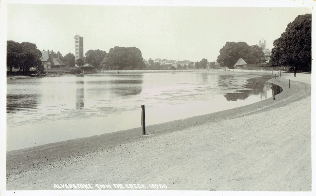
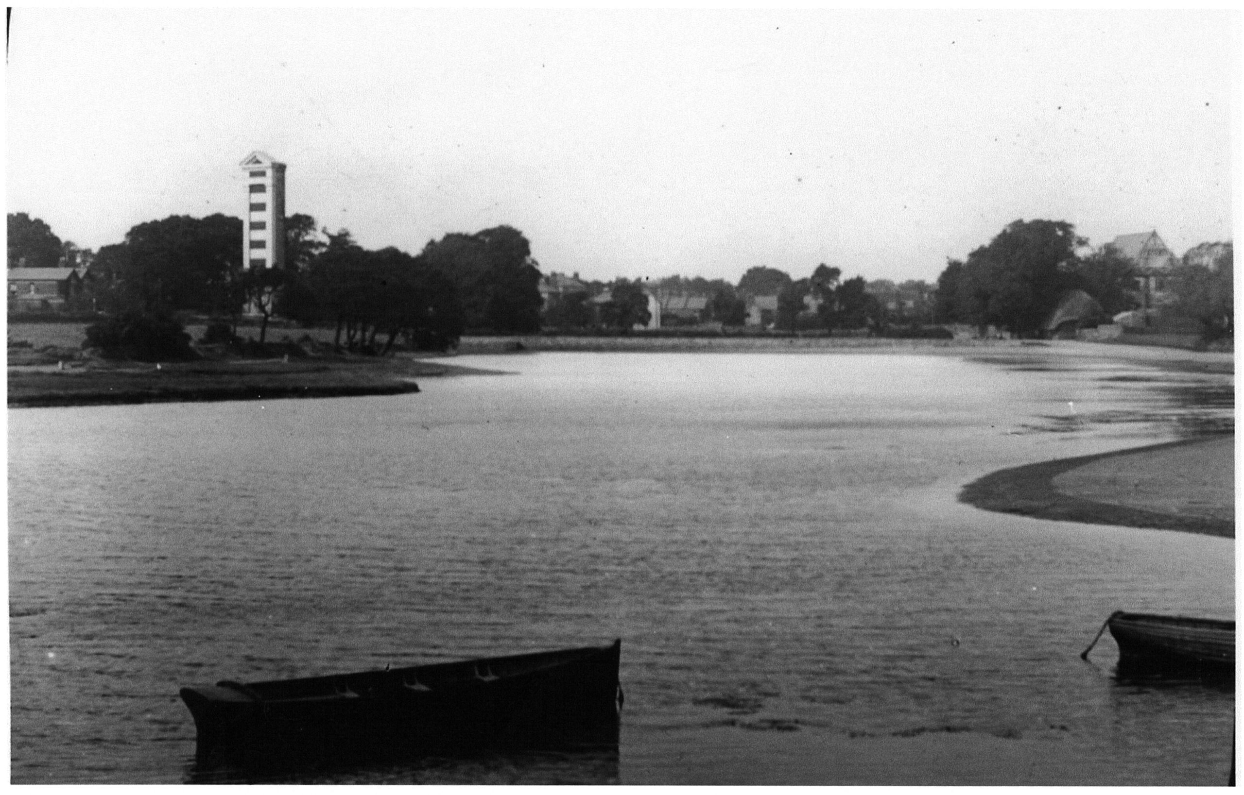
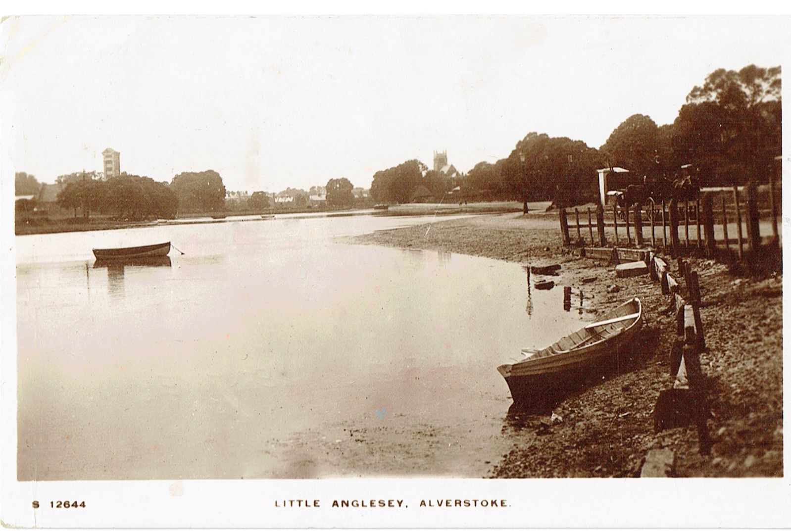
The Kickergill must have been a familiar sight to anyone visiting Stokes Bay beach and the surrounding area for many years. It dominated the skyline if you looked back from the beach towards the church tower at Alverstoke.
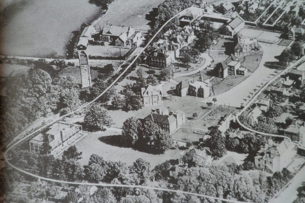
It became obscured by trees and buildings in later years as the area was built on, first the Crescent and then the buildings within the National Children’s home.
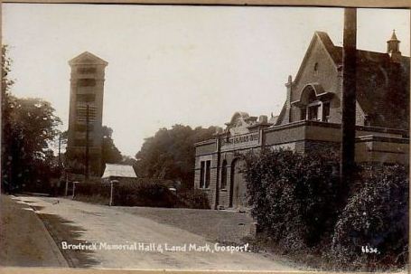
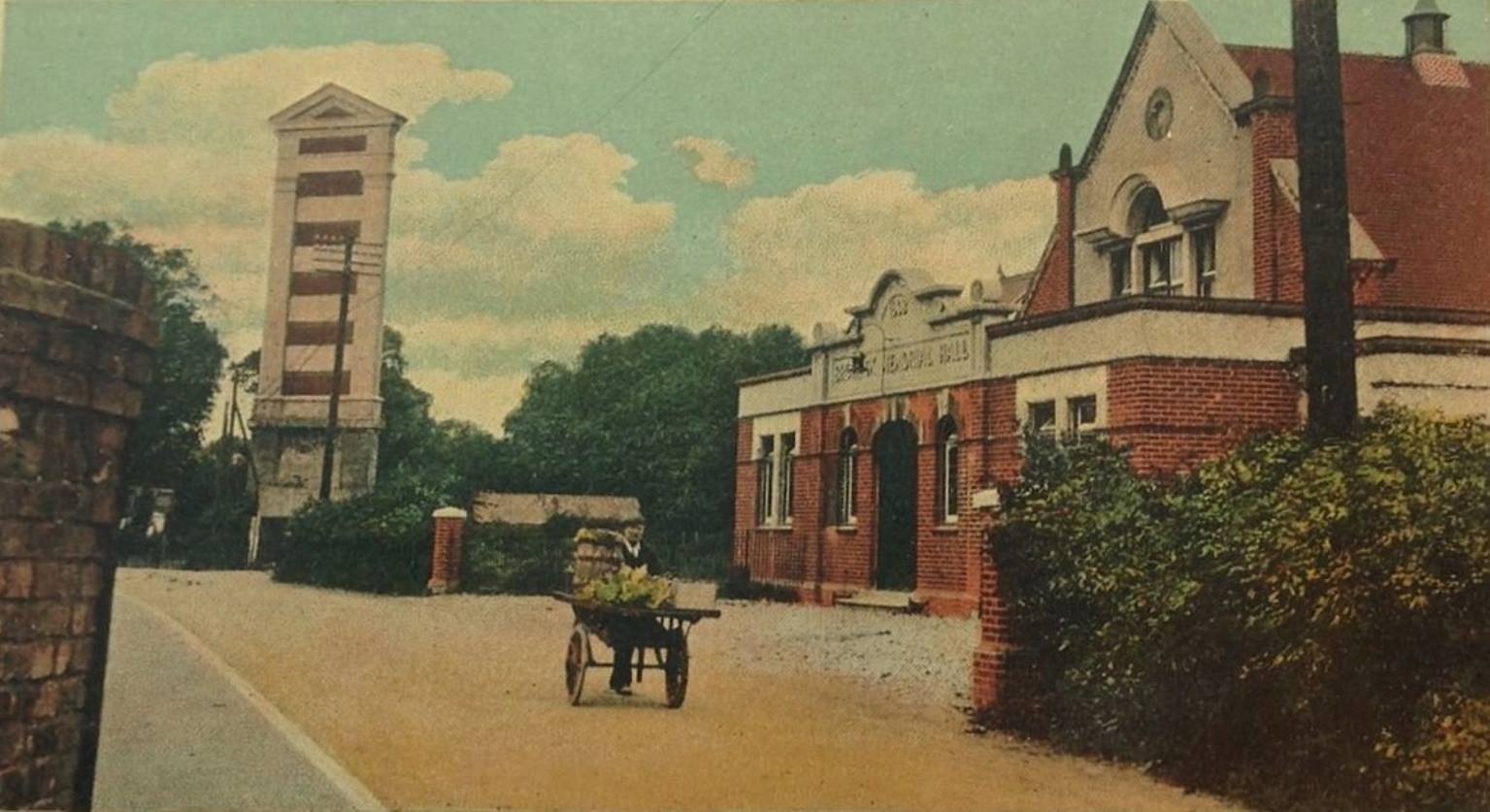
Anyone travelling along Clayhall Road to and from Haslar could not miss it as it stood very close to the road. This was significant in its demise as the then Gosport Council used this as an excuse to demolish it in 1965. The Admiralty had no further use for it post World War Two when better systems of ship’s navigation were introduced that did not require line of sight. Gosport Council were offered it by the Admiralty in January 1937 and the Roads and Works Committee reported that the site of Kickergill Beacon Tower was transferred from the Admiralty to GBC ‘for demolition’.
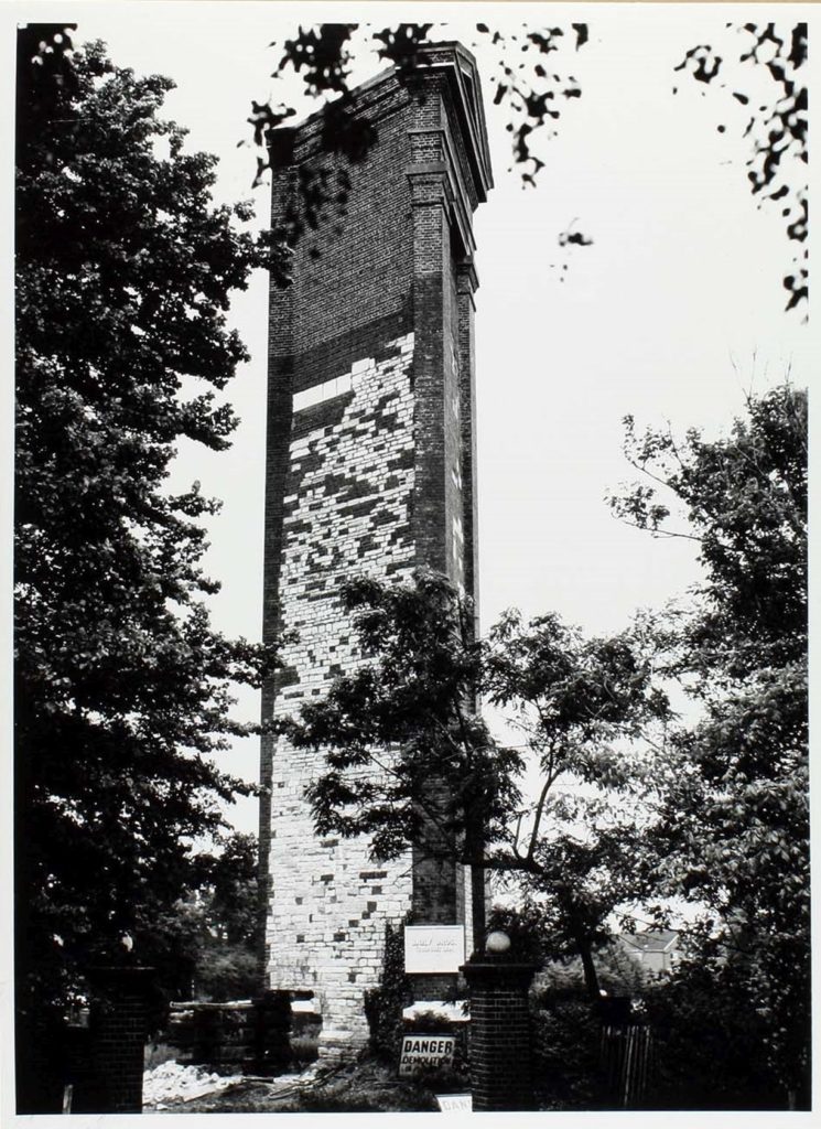
The War delayed any decisions regarding its future but in 1965 the Roads and Works Committee minuted that …the Demolition of Gilkicker Tower, Clayhall Road was to allow road realignment and it was due 1966-67; It must be demolished before surveying etc can be done. Next year a pumping station was to be built to restore the Children’s Home land on which it stood to a playing field. The tower will be felled onto this land; The Ministry of Public Buildings and Works say the tower is ‘not worth scheduling’. Ask the specialists or Army to demolish it.
In 1965 the Council reported that the Minister of Housing & Local Government proposed additions to the provisional list of Buildings of Architectural or Historic Merit including Gilkicker (it meant Kickergill) Tower. They were told to remove Kickergill from the list as it was to be demolished.
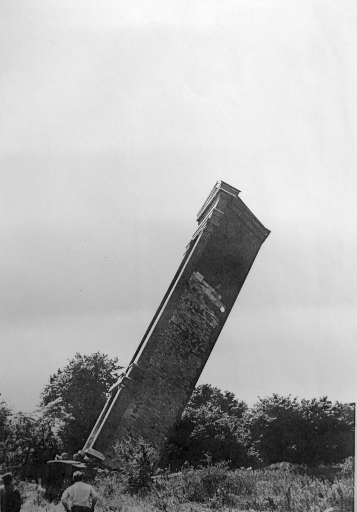
They recorded that a contract with Bailey Bros was given to demolish Kickergill Tower. Some local residents opposed the demolition but it was inevitable. Kickergill was defiant to the last as a traditional method of demolition was chosen. In June 1965 a section of the back was removed and supported on wooden beams. When this was set on fire the tower teetered but eventually it fell. A sad ending to such a well known Gosport landmark. No doubt it would have survived if the current interest in local history had existed back then. We have lost this Stokes Bay landmark but a few photographs remain, including these by Stephen Weeks. Although the tower was constructed mostly of brick some local residents have reported that some stone block were reused to built fireplaces and features in their nearby houses.
The name ‘Gilkicker’ has survived, as the spit of land on which it stood took the name Gilkicker Point from this seamark. The name ‘Kickergill’ lives only in some memories but is destined to fade. Perhaps we need an interpretation board on its site before we lose the memory for ever.