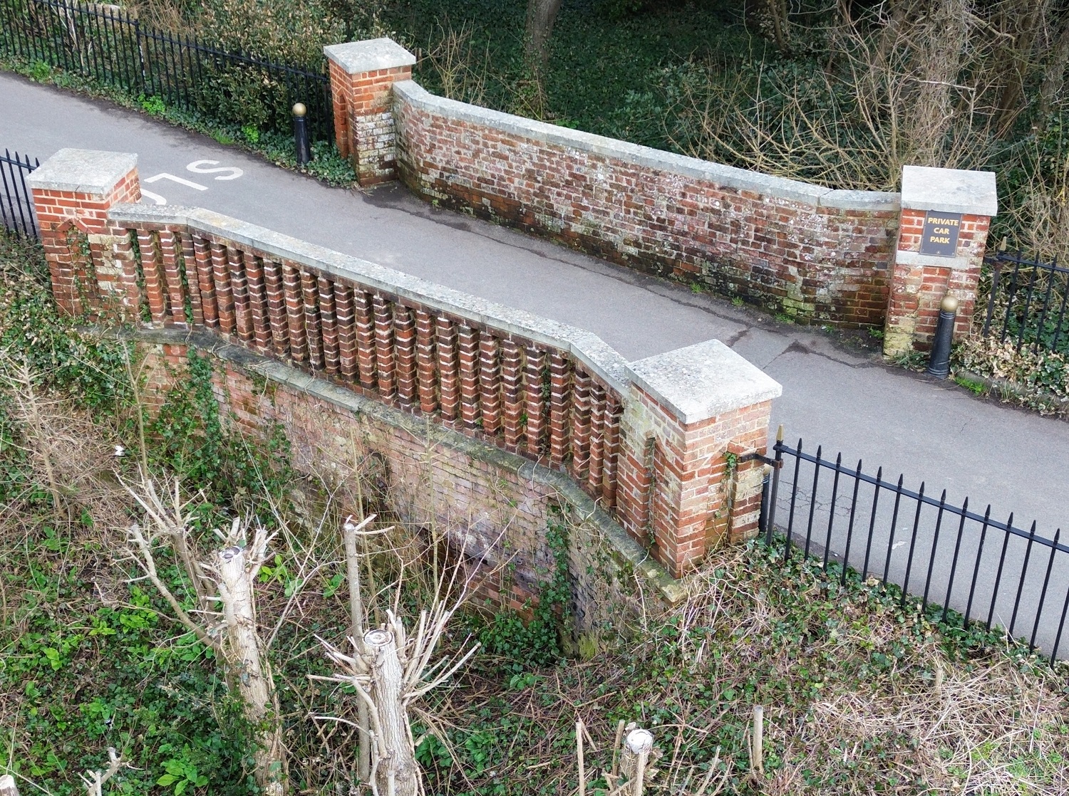
The small brick bridge that you cross when walking to the bay from Stanley Park replaced the original bridge built in 1842 to enable the owner of the Alverbank to cross the River Alver to get to the sea. The bridge that you now cross, which is Grade II Listed, was built by the Royal Engineers when the river was diverted in 1860; the dried up river bed is now overgrown.
The River Alver river once flowed from the wild grounds south of Fareham, seawards, towards Stokes Bay and turned eastward at Gomer Ponds to run the length of Stokes Bay, finally exiting to the sea via a huge ‘Morass’ close to Fort Monckton. But there is no river here now!
Beneath the bridge is the overgrown, dried up, river bed, barely recognisable as such. In 1860 the River Alver was diverted into the newly constructed Stokes Bay Moat which ran along the length of Stokes Bay from No1 and No2 Batteries in the west to Fort Gilkicker and Fort Monckton in the east, a distance of 2,700 yards. Known as The Stokes Bay Lines it was completed by 1870 at a cost, calculated to be £75,120. The moat itself was lined with concrete and was 60ft in width and contained water to depth of 9ft at high water of Spring tides. The R.E. bench mark (a broad arrow) on one of the pillars that reads 5.56ft above LMS (Local Mean Sea level). The brick parapets and pillars were recently re-built but happily the bench mark and inscription survived.
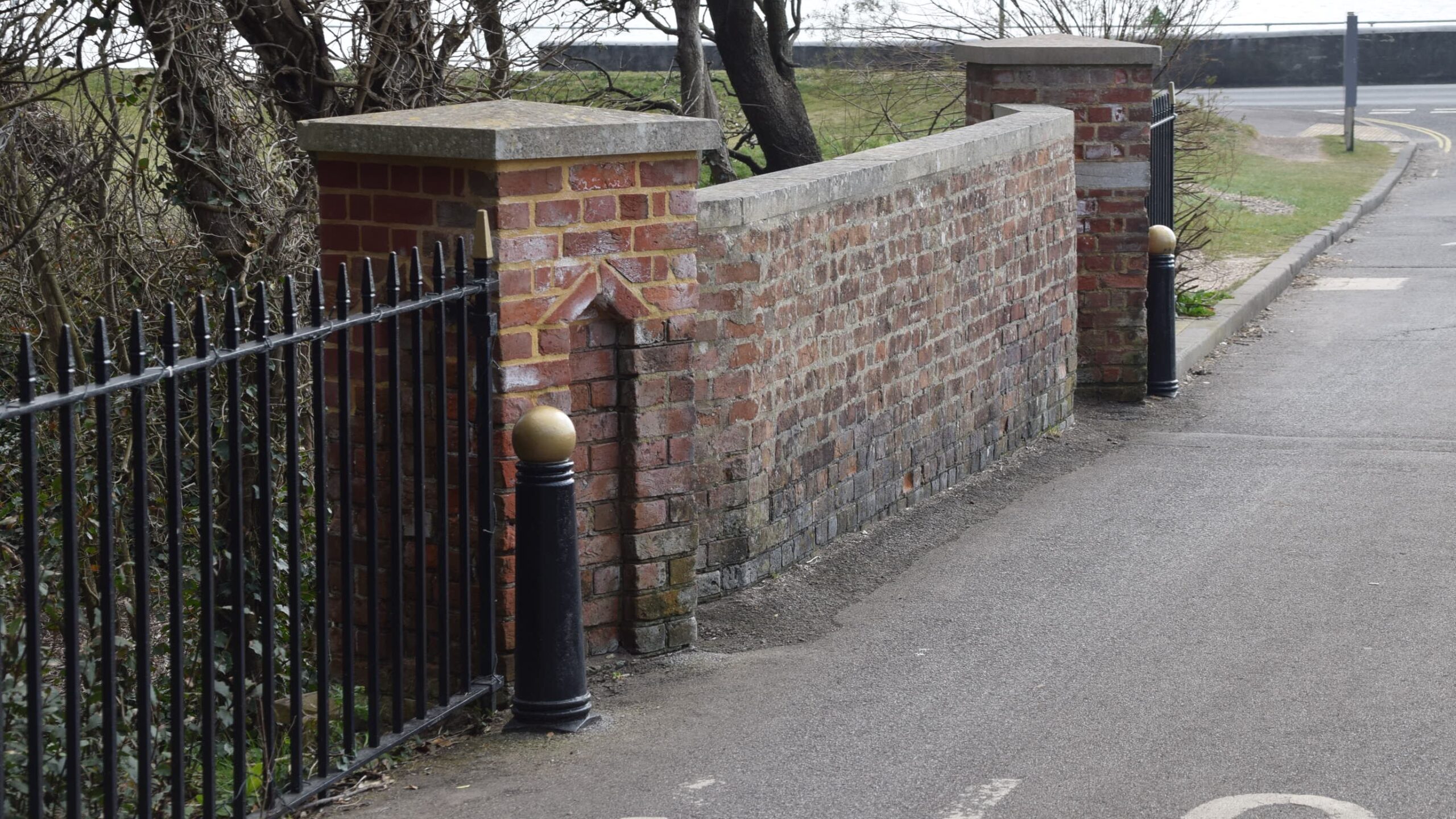
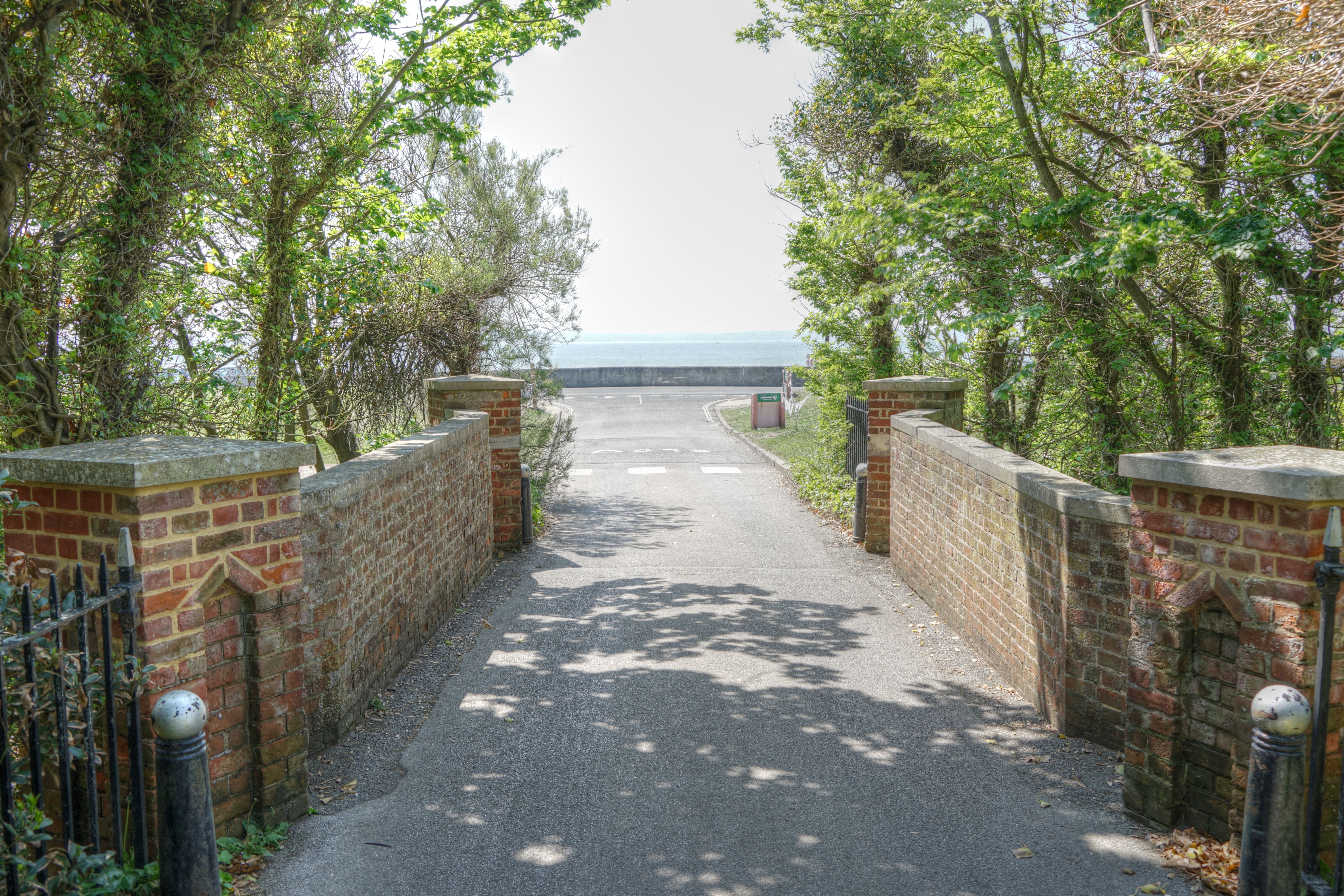
When over the bridge you can look left and right to see where the Stokes Bay Moat once ran in both directions. There was a second bridge here crossing the moat and this can be seen in old postcards. When the weather is particularly dry you can sometimes see the concrete sides of the moat, which is still there beneath the grass. The moat was not destroyed, this section was merely filled with rubbish after an appeal to Gosport house holders to supply it. The section from No.2 Battery to Alverbank was filled first from October 1954 so that the Stokes Bay Road and promenade could be widened. The section in front of Palmerston Way survived until 1966, at the request of the residents who wanted to keep it. If you look over the sea wall at low tide you can see the Victorian penstock outlet, a large iron pipe, that allowed the Royal Engineers to maintain the depth of water in the moat. The filled-in moat is now piped to this outlet.

A